Drone Services Sydney

Providing new solutions to old problems across Australia

Aerial Survey, Inspection, Mapping & Media

sydney-drone-services
SYDNEY DRONE SERVICE PROVIDER

High Exposure is a leading commercial drone services company in Sydney since 2016. This time in the industry has allowed us to fine tune our skills in a range of services and sectors. 

Our expert team of drone pilots specialises in providing top-tier aerial solutions tailored to meet your specific needs. Whether you require meticulous inspections of industrial sites, detailed surveys for construction projects, or captivating aerial photography and videography for marketing purposes, we have you covered. Our class leading aerial aircraft and payloads combined with our skilled operators ensures unparalleled accuracy and efficiency in every project we undertake. From capturing breathtaking views of landscapes to conducting intricate inspections of infrastructure, we excel in delivering high-quality results that exceed expectations. Trust High Exposure and their experienced drone operators for all your commercial drone needs in Sydney, and let us elevate your perspective to new heights.

What we do

Expertise

Sydney Drone Inspection

Faster, safer and cost efficient drone data provides complete and comprehensive knowledge of your asset void of gaps as opposed to using traditional methods.

Sydney Drone Survey

Precise photogrammetry analysis for projects of any size. We are able to provide you with accurate 3D reconstructions of any environment ready for analysis using an array of survey tools.

Construction

Efficiently collect aerial data in order to improve site planning and quality control, manage assets, and reduce risk on the job site.

Media and Promotion

Our high-resolution aerial footage and talented drone pilots provide clients with the content they need for business promotional projects, events, TV and cinema

Get in touch

Whether you have a specific project in mind or you're exploring possibilities. Our team is passionate about turning ideas into reality, and we thrive on collaborating with clients to create meaningful solutions
Why Choose Us

The Most Effective Solutions for your Problem

Expertise & Experience

Our team has been capturing aerial and spatial data since 2016, providing a wealth of knowledge and experience in the field. We have built proven methodologies and scopes of work for every scenario

Licensed & Insured for $20 million public liability

Safety is our highest priority in all of our operations. We hold all required CASA licenses and insurance to ensure a smooth operation

Target Oriented

Your project goal is our priority. Our team of passionate professionals will work with you to ensure we get a result that solves your questions

Let's start your project to be realize.

We planted our roots with a commitment to earning your trust and protecting lives, property, and prestige.
Play Intro

Some of our Work

Our Projects

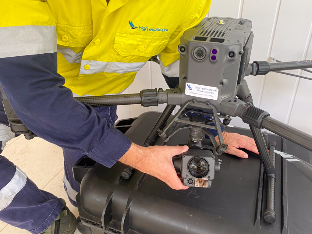
River Bank LiDAR Survey

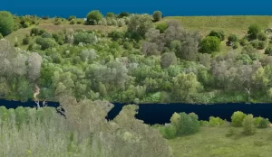
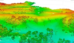
Project Objectives High Exposures was commissioned to conduct a LiDAR survey on an 800-meter section of the Nepean River. The objective of this survey was
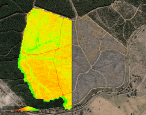
Read More »