River Bank LiDAR Survey
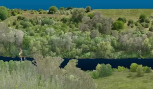
Project Objectives High Exposures was commissioned to conduct a LiDAR survey on an 800-meter section of the Nepean River. The objective of this survey was
Project Objectives High Exposures was commissioned to conduct a LiDAR survey on an 800-meter section of the Nepean River. The objective of this survey was
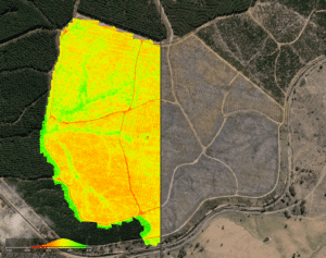
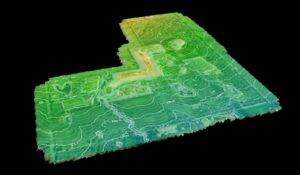
Project Objectives A 340ha parcel of land, located one hour west of Sydney, was assessed by developers for a preliminary development application. High Exposure was
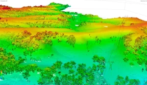
Project Overview Client: ACT Parks and Conservation Project Location: Kowen Forest, Canberra Survey Area: 780ha Project Duration: 1 week Objective: ACT Parks and Conservation required an aerial survey to assess
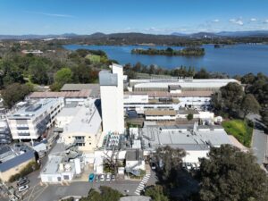
High Exposure was engaged by the main contractor overseeing the remedial repairs of Australian National University in Canberra to assist with assessing damages to a
High Exposure Commercial Drone Services undertook an aerial survey at the 250-hectare Gregadoo Waste Management Facility, employing drone photogrammetry and LiDAR capture techniques. The primary
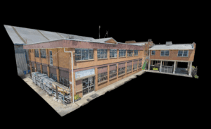
High Exposure was engaged to undertake a significant project to create a high-resolution aerial photogrammetry 3D model for a thorough inspection of brickwork on the
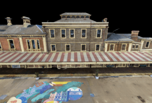
High Exposure, a leading provider of aerial surveying and photogrammetry solutions, was contracted to undertake a comprehensive survey of the Old Newcastle Station. The council
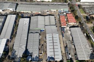
High Exposure was enlisted to conduct a comprehensive roof inspection for a 20,000m² warehouse as part of a due diligence process before the property’s purchase.
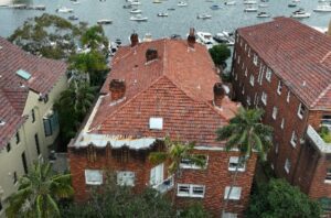
High Exposure, a leading drone inspection company, was tasked with conducting a comprehensive roof and chimney inspection in Double Bay, Sydney. The primary goal was

The Rydges Hotel was planning on adding some structural changes to the building. There were no current plans to utilise for the design and therefore