


LiDAR
River Bank LiDAR Survey
Project Objectives High Exposures was commissioned to conduct a LiDAR survey on an 800-meter section of the Nepean River. The objective of this survey was

LiDAR
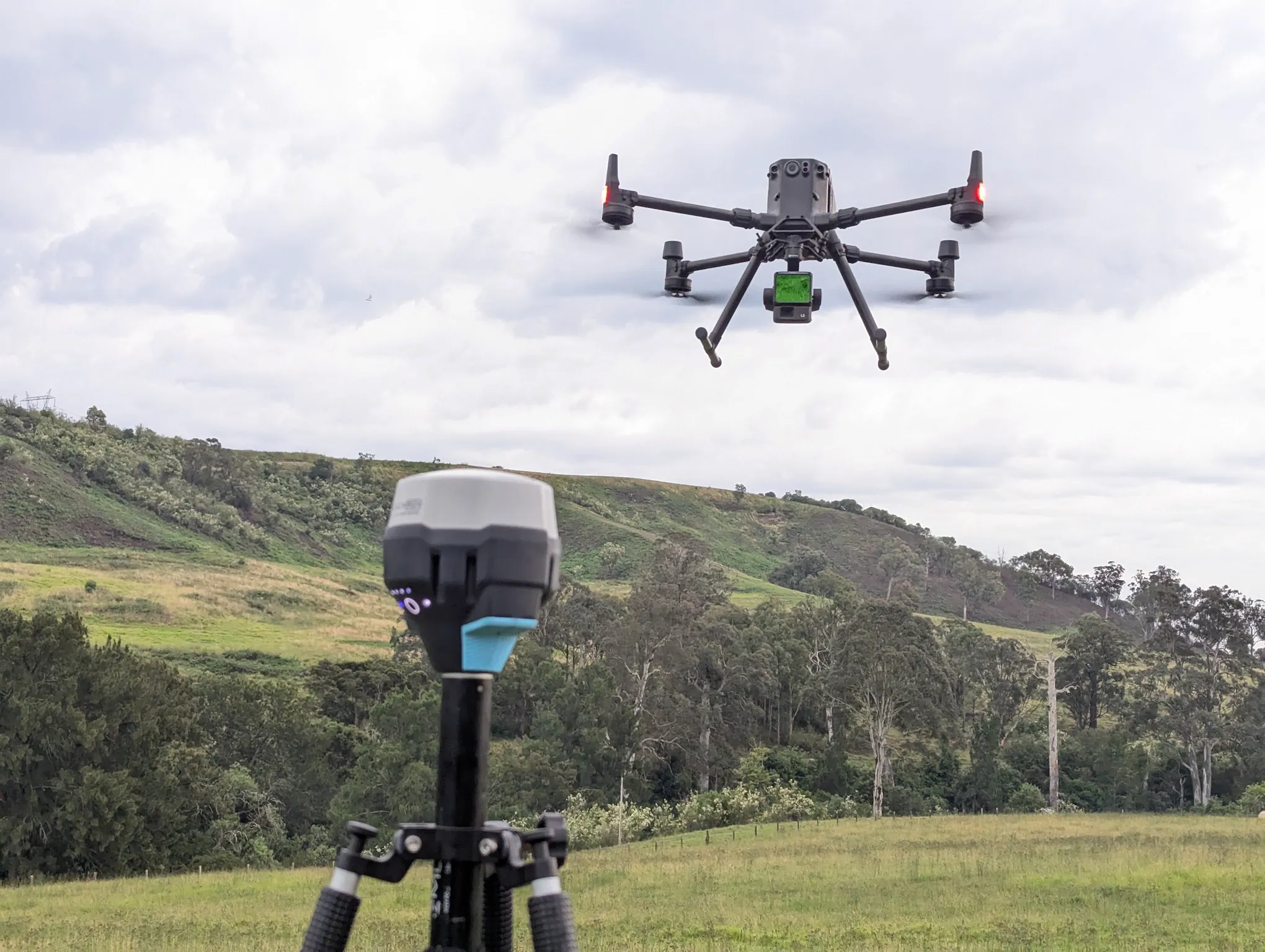
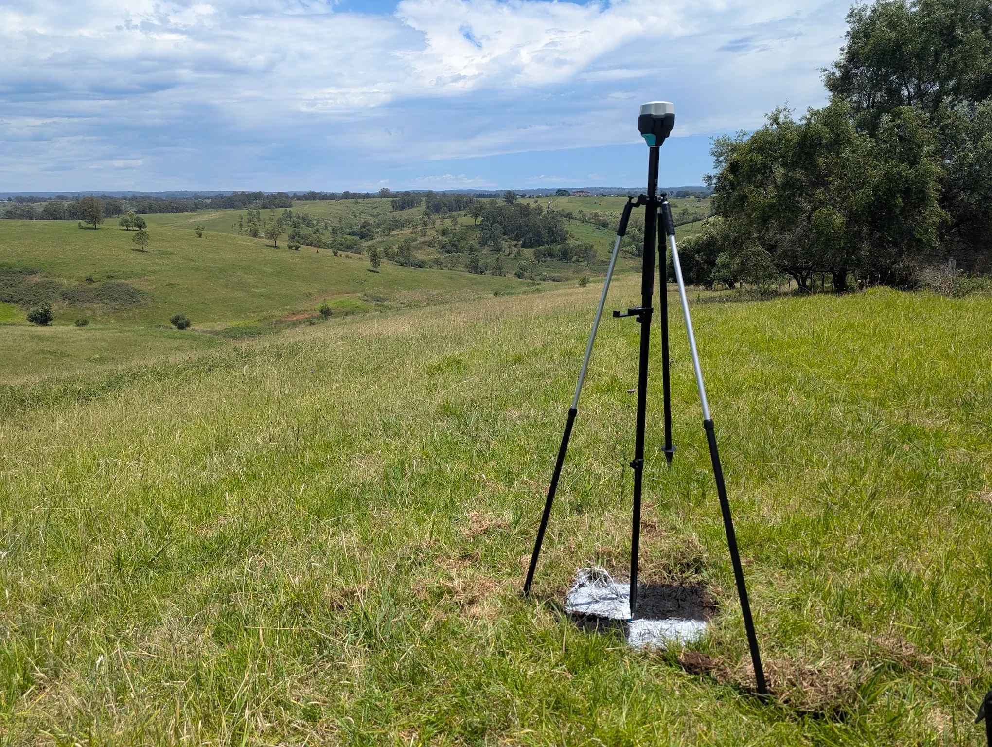
Drone LiDAR Survey – Development Area Assessment
Project Objectives A 340ha parcel of land, located one hour west of Sydney, was assessed by developers for a preliminary development application. High Exposure was

LiDAR
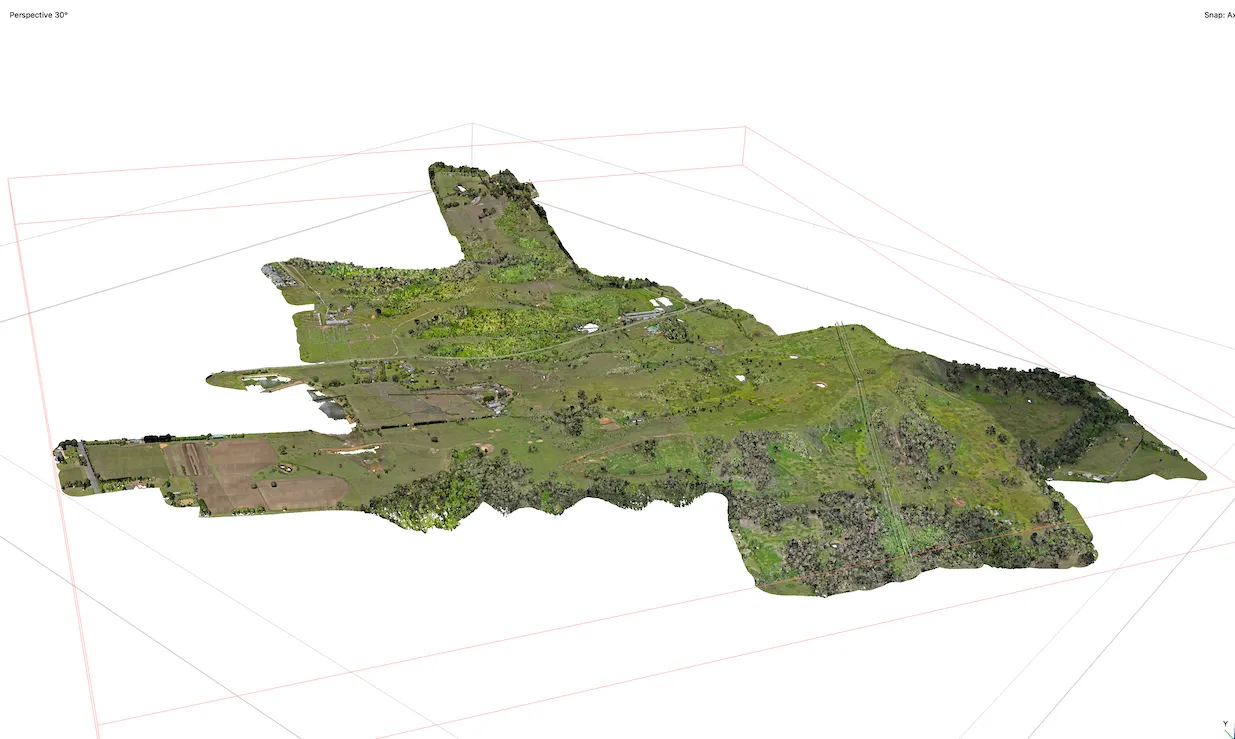
Drone LiDAR & Photogrammetry Survey – Gregadoo Waste Management Centre
High Exposure Commercial Drone Services undertook an aerial survey at the 250-hectare Gregadoo Waste Management Facility, employing drone photogrammetry and LiDAR capture techniques. The primary