Project Objectives
McMahon Transport, a leading logistics and transport company, was required to provide the Environmental Protection Agency (EPA) with accurate volumetric calculations for their wood chip and logs stockpiles. The stockpiles were located at their facility and needed to be measured to ensure compliance with EPA regulations regarding environmental management.
The EPA required that the stockpile volume calculation be within a strict tolerance of +/- 0.2 meters. This accuracy was essential to ensure that McMahon Transport met the necessary environmental standards and avoided potential penalties. To achieve this, the company partnered with High Exposure to conduct a precise volumetric survey using state-of-the-art technology.

Colourised point cloud LiDAR data set shown on the left. The image on the right shows the vegetation removed after ground points were classified.
Challenges:
The project presented several challenges that required careful planning and execution:
Strict Accuracy Requirement: The EPA’s tolerance of +/- 0.2 meters required an exceptionally high level of precision, especially when measuring large stockpiles.
Complex Terrain and Stockpile Shape: The wood chip and log stockpiles were not uniform in shape, which could lead to complexities in accurate volumetric measurement. Additionally, the site had varying terrain that required careful attention during data capture.
Time Constraints: The survey needed to be completed within a short timeframe to ensure McMahon Transport could submit the results promptly to meet regulatory deadlines.
Equipment Used:
To overcome these challenges, High Exposure utilised cutting-edge equipment:
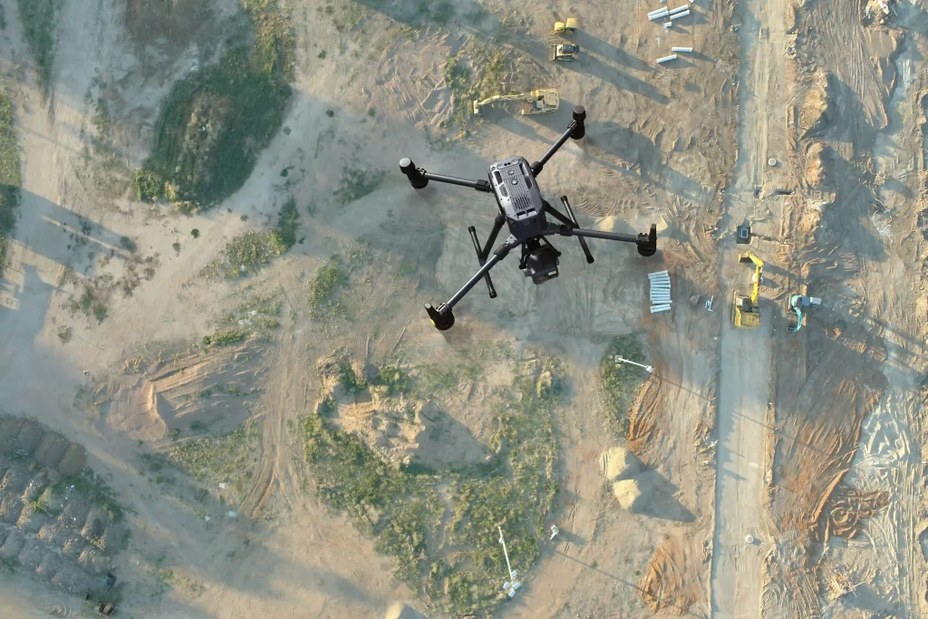
- Drone: A high-performance UAV (Unmanned Aerial Vehicle) equipped with high-resolution cameras and photogrammetric software was used for aerial data collection.
- Photogrammetry Software: Advanced photogrammetry software was employed to process the drone-captured imagery and convert it into accurate 3D models and volumetric measurements.
- GPS and RTK Technology: To ensure accuracy, High Exposure integrated Real-Time Kinematic (RTK) positioning with the drone to ensure centimeter-level precision.
- Ground control points were laid and recorded using an RTK GNSS receiver. These were used to validate the survey accuracy.
Methodology
Site Preparation:
- A pre-survey assessment was conducted to review the terrain and determine the best flight path for the drone.
- High Exposure collaborated closely with McMahon Transport to ensure that the stockpiles were accessible and safe for aerial survey operations.
Data Capture:
- The drone flew over the stockpile area, capturing high-resolution images from multiple angles to create a detailed, overlapping set of photos.
- RTK technology was used to pinpoint the drone’s location to within a few centimeters, ensuring the accuracy of the data.
Data Processing and Analysis:
- The images were processed using photogrammetry software to generate 3D models of the stockpiles.
- The volumetric calculations were extracted from the 3D model by comparing the surface of the stockpiles with the ground level.
Verification:
- High Exposure performed quality control checks on the processed data to ensure that the volumetric calculations met the required tolerance of +/- 0.2 meters. The accuracy of the final result was within an impressive 0.02 meters, far exceeding the EPA’s requirements.
Deliverables
- 3D Model of the Stockpiles: A high-resolution 3D representation of the wood chip and logs stockpiles, providing a visual reference for the EPA.
- Volumetric Calculation Report: A comprehensive report containing the calculated volume of each stockpile, with detailed breakdowns for both wood chips and logs.
- Survey Data and Raw Imagery: All raw data, including aerial imagery and 3D models, was provided to McMahon Transport for their records and future reference.
Result:
The volumetric survey was completed with remarkable precision, exceeding the EPA’s required tolerance of +/- 0.2 meters. The final measurements were within just 0.02 meters of the actual volume, ensuring that McMahon Transport remained fully compliant with EPA regulations.
The use of photogrammetry with a drone allowed for rapid, non-intrusive data collection, which saved time and minimized disruption to the operation at McMahon Transport. The project was delivered on time and within budget, demonstrating High Exposure’s capability to meet strict regulatory requirements and provide high-quality, actionable results.
By partnering with High Exposure, McMahon Transport not only fulfilled its EPA compliance obligations but also gained valuable insights into their stockpile management practices, enabling them to improve their operational efficiency moving forward.
Conclusion
While drone based LiDAR is also a highly capable and appropriate tool for projects such as these, this project highlights how in many use cases aerial photogrammetry is able to deliver precise, efficient solutions for environmental compliance. By combining advanced equipment with expert methodology, High Exposure successfully met McMahon Transport’s challenging requirements and helped them achieve a high standard of regulatory compliance.
Update
Our Projects

River Bank LiDAR Survey
Project Objectives High Exposures was commissioned to conduct a LiDAR survey on an 800-meter section of the Nepean River. The objective of this survey was

Drone LiDAR Survey – Development Area Assessment
Project Objectives A 340ha parcel of land, located one hour west of Sydney, was assessed by developers for a preliminary development application. High Exposure was

Drone LiDAR & Photogrammetry Survey – Gregadoo Waste Management Centre
High Exposure Commercial Drone Services undertook an aerial survey at the 250-hectare Gregadoo Waste Management Facility, employing drone photogrammetry and LiDAR capture techniques. The primary